During the last 150-200 years, the Bay of Bengal has delivered four times more cyclones than the Arabian Sea. But this may soon switch, thanks to global warming.“ For every four cyclones in the Bay of Bengal, there is one in the Arabian Sea. We have data for more than 150-200 years. When you look at this data and calculate, a ratio of 1 is to 4 is established,” says KS Hosalikar, Head SID, Climate Research & Services, Pune India Meteorological Department said.
Describing the cause for this significant variation between the number of cyclonic winds on the eastern and western coasts of India, KS Hosalikar said that various factors influence the formulation of a storm in the sea.“There are various reasons for it, including the geographical location, the sea surface temperature (SST, as well as salinity of the sea. All of these play an important role,” Hosalikar said.
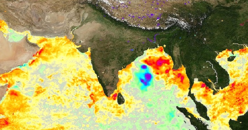
But this proportion may soon vary. Research by The Indian Institute of Tropical Meteorology has revealed that both the regularity and severity of cyclones in the Arabian Sea are on the increase. The experts assume the key reason is a growth in the ocean temperature.“The ideal sea temperature or SST for the formation of cyclones is 28.5 degrees Celsius. At the usual 28 degrees SST, the Bay of Bengal is categorized as a warm pool region. Cyclones draw their energy from the warm pool regions,” Roxy Koll of The Indian Institute of Tropical Meteorology said.
“Traditionally, the Arabian Sea is a lot cooler than the Bay of Bengal. But now the Arabian Sea is also becoming a warm pool region because of the additional heat supplied by global warming,” he said. According to authorities, the Bay of Bengal also receives many parts of the cyclones in the Pacific Ocean. They appear as a low-pressure region into the Bay of Bengal and evolve into cyclones due to perfect circumstances. Apart from being a hot pool area, the Bay of Bengal is somewhat more landlocked with southeast Asian nations encompassing it, related to the Arabian Sea, which is more open and this also drives to an increase in salinity of the seawater.
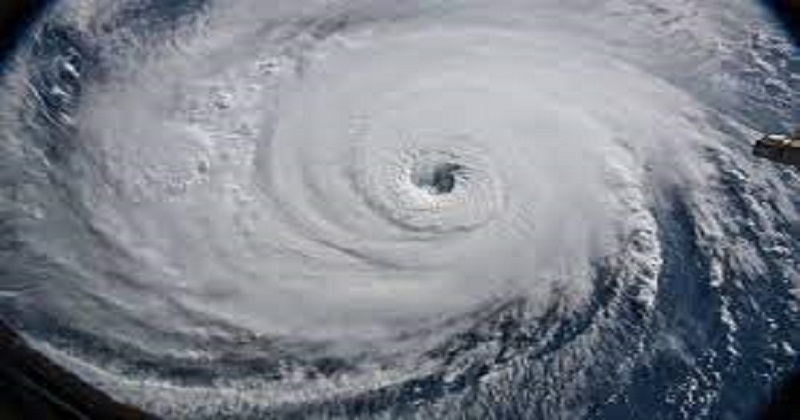
Several drifts are fixed up in the sea over the Bay of Bengal as well as the Arabian Sea which support obtain information on temperature, pressure, wind speed, etc. This knowledge helps the experts manage their study but they say that there is a requirement to have a more extensive network of drifts in the sea to make better and more reliable data. Hosalikar said there is a need to study the ‘rapid intensification of the system’. The development of a cyclone starts from a ‘low pressure’ to a ‘well-marked low pressure’ to a ‘depression’ to a ‘deep depression’ to a ‘cyclonic storm’ than a ‘severe cyclone’ to a ‘very severe cyclone and then an ‘extremely severe cyclone’ and finally, a ‘super cyclone.
Specialists say that before, the formation of typhoons used to take a long period between different stages. But presently, the strength of a cyclone can vary overnight.“These cyclones are intensifying into a super cyclone or an extremely severe cyclone in less than 24 hours. So, it may be a weak cyclone when you go to sleep and a severe cyclone at your doorstep when you wake up. That gives us less time to respond,” Roxy Koll said.
Post Your Comments