NASA scientists discovered evidence that an area of northern Mars called Arabia Terra witnessed hundreds of ‘super-eruptions,’ the largest volcanic explosions known, over a 500 million year span.
According to estimations published in the journal Geophysical Research Letters, these explosions tore through the Martian surface around 4 billion years ago, spewing water vapour, carbon dioxide and sulphur dioxide into the air.
Patrick Whelley, a geologist at NASA’s Goddard Space Flight Center in Greenbelt, Maryland, said: ‘Each one of these eruptions would have had a significant climate impact — maybe the released gas made the atmosphere thicker or blocked the Sun and made the atmosphere colder. Modelers of the Martian climate will have some work to do to try to understand the impact of the volcanoes.’
Volcanoes on Mars? ?
Evidence has been found that a region of northern Mars has experienced thousands of “super eruptions,” blasting the equivalent of 400 million Olympic-sized swimming pools of molten rock & gas, over 500-million years. Discover more: https://t.co/2BF55tPYzm pic.twitter.com/DJYexYlF4K
— NASA (@NASA) September 15, 2021
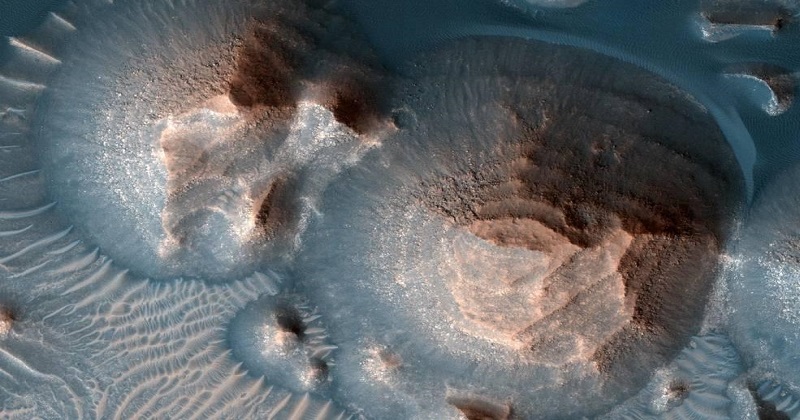
A volcano of this size collapses into a gigantic crater called a ‘caldera’ after blasting the equivalent of 400 million Olympic-size swimming pools of molten rock and gas through the surface and spreading a thick layer of ash thousands of kilometres away from the eruption site.
Calderas, which are also found on Earth, can be hundreds of miles wide. The researchers discovered seven calderas in Arabia Terra, which were the first signs that the region may have formerly been home to super-eruptive volcanoes. The team followed the theory of other scientists, who have previously indicated these basins were volcanic calderas. The first research based on this theory was published in 2013.
‘We read that paper and were interested in following up, but instead of looking for volcanoes themselves, we looked for the ash, because you can’t hide that evidence,’ Whelley said.
Also Read: Password free accounts for Microsoft users
The researchers identified the minerals in the surface using pictures from MRO’s Compact Reconnaissance Imaging Spectrometer for Mars. They discovered volcanic minerals such as montmorillonite, imogolite, and allophane in the sides of canyons and craters hundreds to thousands of kilometres away from the calderas, where the ash would have been transported by wind.
The team then created three-dimensional topographic maps of Arabia Terra using pictures from MRO cameras. The researchers were able to discern the layers of ash in the mineral-rich deposits by overlaying the mineral data over topography images of the canyons and craters studied. Instead of being jumbled by winds and water, the ash was stacked in an exact manner it would have been when it was fresh.
Post Your Comments