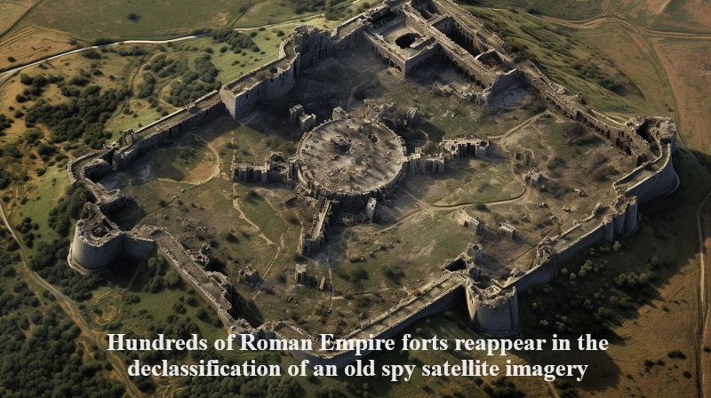
The declassification of aged spy satellite images, encompassing regions like Iraq, Syria, and the surrounding “fertile crescent” territories in the eastern Mediterranean, has revealed the existence of hundreds of Roman Empire forts.
These satellites, utilized for reconnaissance purposes in the 1960s and 1970s, have now had their data declassified. Some of the archived images captured by these satellites are now unlocking fresh opportunities for archaeological discoveries in areas that are typically challenging for researchers to access.
Among these images, researchers have identified 396 Roman forts, which were visible directly from space. An aerial survey of the region was conducted in 1934, documenting 116 forts along the eastern frontier of the Roman Empire. The conclusions drawn in this nearly century-old study suggested that Rome was fortifying its frontier, a perspective that the new study has expanded upon.
Lead author Jesse Casana, an anthropology professor specializing in the Middle East at New Hampshire’s Dartmouth College, stated that these newly discovered forts closely resemble Roman forts found in Europe and North Africa. The higher number of forts in their study may be attributed to their better preservation and recognition. Still, Casana noted that it could also be due to intensive fort construction, particularly during the second and third centuries AD.
What significantly contributes to the new study is the clear, high-resolution, and stereo perspective imagery captured by these satellites. These images offer a unique resource for archaeological research, preserving landscapes that have been heavily impacted by modern land-use changes, such as urban expansion, intensified agriculture, and reservoir construction.
The declassification of these images has provided archaeologists with a wealth of valuable data. These satellite images are publicly accessible through the U.S. Geological Survey’s EarthExplorer data distribution portal. Downloadable scanned images are available for free, while unscanned ones can be purchased for $30 USD. After downloading, the images underwent extensive processing, including spatial correction and georeferencing.
Post Your Comments