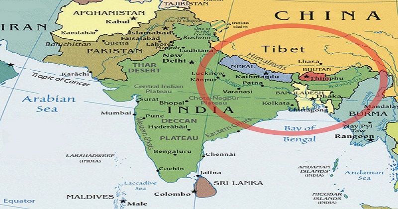
NEW DELHI: A new political map that identifies Indian territory in Uttarakhand’s Pithoragarh as its own, Nepal has inscribed the changes in its academic curriculum and currency.Now a book to “teach students” about Nepal’s territory and border disputes, mainly with India, has raised questions whether it was necessary.
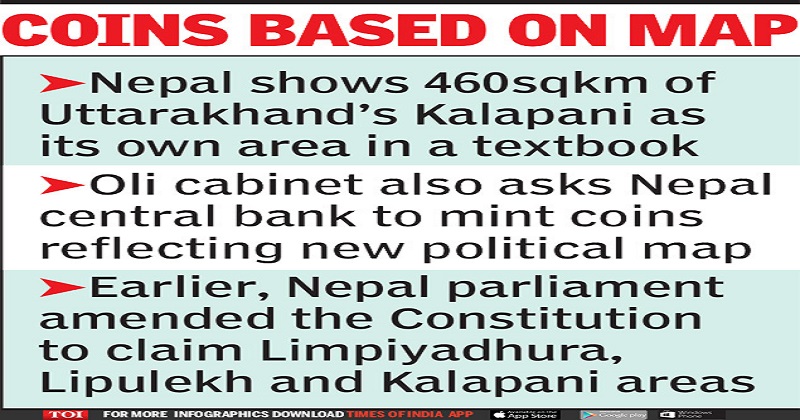
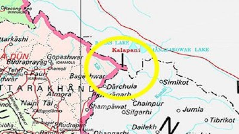
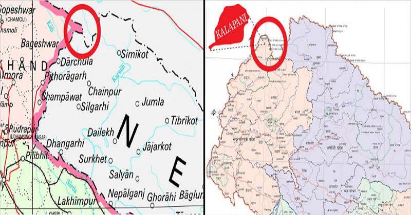
The book, ‘Nepalko Bhubhaag Ra Seema Sambandhi Swadhyay Samagri (Nepal’s geography and territorial boundary)’ has been introduced for higher secondary school students. The preface has been written by Pokharel. The book includes the disputed area of Kalapani in Uttarakhand as Nepal’s territory. A source said it mentions Nepal has a geographical area of 1,47,641.28 sq km, of which 460 sq km is the Kalapani area.
The publication of the book, according to Minister for Education Giriraj Mani Pokharel, was provoked by the Indian government’s move on last year to publish its political map depicting Kalapani within Indian borders. Nepal claims Kalapani as its own territory.
The same day, the Nepal cabinet, headed by PM K P Oli, also gave permission to the country’s central bank, Nepal Rastra Bank, to mint new coins of one-rupee and two-rupee denominations with the new political map.Sources said this was announced by the Nepal government spokesperson and foreign minister Pradeep Gyawali. In all likelihood, sources added, the new coins will be in circulation by Dussehra (Dashain, as it’s called there), celebrated as a major festival in the neighbouring country.
In November last year, Nepal had protested against the inauguration of a key Lipulekh road in Pithoragarh by Union defence minister Rajnath Singh, alleging that a part of the stretch passed through Nepal’s territory. After a renewed dispute over three areas Limpiyadhura, Lipulekh and Kalapani Nepal’s parliament unanimously voted to amend the Constitution to update the country’s map to include them as part of its land. The government had then announced that all documents will start using the new map.So now, a source said, introduction of the map in school books and coins is “fully legal” because it follows what is a regular course of action. “The government has started the process of issuing the new maps to Nepal embassies and is introducing it in government gazettes as well,” the source added.
Many in Nepal, meanwhile, said the need for a resolution is getting more important by the day. “There have been misunderstandings between the two nations over the past few months. However, introducing a new Nepal map is a sovereign decision by the country,” Khadga KC, head of the department of international relations and diplomacy at Tribhuvan University said.
Post Your Comments