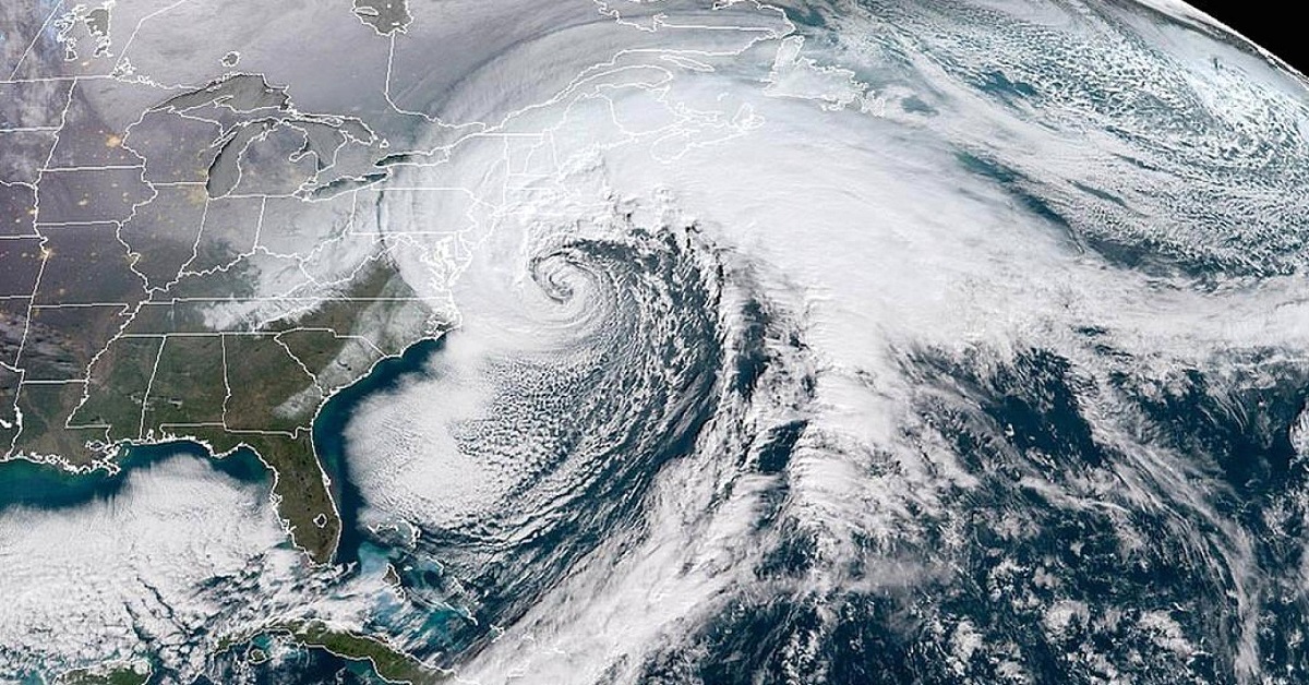
In the first week of January, a snowy nor’easter barreled up the East Coast. The storm was technically called a “bomb cyclone,” an intimidating but scientific name given to a particular breed of storm which strengthens quickly and often include strong winds and heavy rainfall. The storm hit Florida and the Southeast on Jan. 3, then South Carolina, North Carolina, Virginia, Delaware and New Jersey on Jan. 4, according to NASA.

It was so large that it was clearly visible from space, and NASA used its satellites to take awe-inspiring images.

NASA also took impressive shots of a particularly freezing winter falling on Savannah, Lake Michigan, across the northern plains and eastern seaboard.

With the bomb cyclone, pictured below from space, the clouds stretch thousands of miles, running from the Caribbean all the way up to New England. Snow fell in Tallahassee, Fla., for the first time in three decades. Ocean City, Maryland, reported three foot drifts of snow.

A photo of bomb cyclone by night was taken at 1:30 a.m. EST on Jan. 4, 2018. In the image below, light is shining down on the clouds from the moon and up on the clouds from cities below. (Image: NASA/NASA Earth Observatory image by Joshua Stevens, using VIIRS day-night band data from the Suomi National Polar-orbiting


Post Your Comments