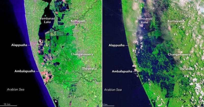
NASA has released the satellite pictures of Kerala before and after the flood. The picture shows areas around Vembanad Lake and places around Kottayam, Changanasery, Alappuzha and Thiruvalla region. The image clearly reveals how devastating the flood actually was.
The first picture(on the left) was taken on February 6th of this month using Operational Land Imager in Landsat 8 Satellite. Obviously, this is a picture taken much before the floods. The second one was taken on August 22. This was taken by the Sentinel 2 Satellite of European Space Agency.
READ ALSO: Did Salman khan Donate 12 Crore Rs to Kerala Flood Relief? Here is the Truth
Post Your Comments