Flood-hit Kerala is still reeling from the devastating effects of the heavy rain that flooded the state.
While we can see the effects of the rain on 2D images while just hitting that search bar, what about a view of the southern state from the space?
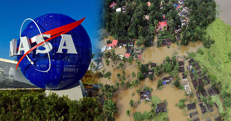
The National Aeronautics and Space Administration (NASA) on Sunday released before and after satellite images which shows the extent of flooding in the Indian state of Kerala.
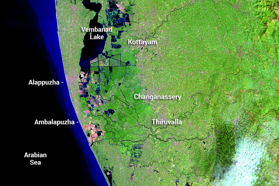
This is the image of Kerala on the 6th of February by the Operational Land Imager (OLI) on the Landsat 8 satellite.
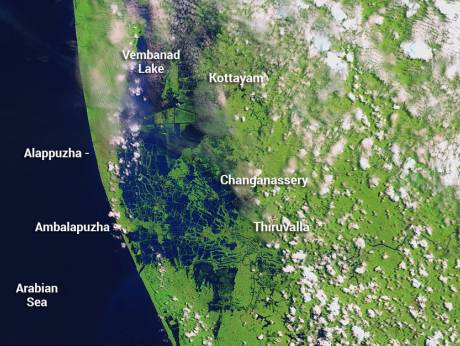
The Multispectral Instrument on the European Space Agency’s Sentinel-2 satellite acquired the image below on August 22, 2018, after flood water had inundated the area. The images are false-color, which makes flood water appear dark blue and the vegetation is bright green.
NASA’s report stated that “several rivers throughout the region spilled over their banks. Water from the Karuvannur River ran through 40 villages and washed away a 2.2km stretch of land connecting two national highways. Elevated water levels along the Periyar River displaced thousands of people.”
Last week NASA shared a video in which the agency analyzed the rainfall in Kerala
See VIDEO uploaded on YOUTUBE:
READ ALSO: Kerala Floods: Rohit Shetty donates huge amount to Chief Minister’s Distress Relief Fund
DID THE OPENING OF DAMS INCREASE THE PROBLEM?
According to the Indian Meteorological Department, Kerala received 771mm rainfall between August 1-20. This is the highest since 1931 when the southern state received 1132.9mm of rainfall in the entire four-month-long monsoon season – 175% more than normal.
Compared to this, in 2018, between August 16-22 Kerala received 219% more than normal rainfall.
Nasa, in an earlier report, had also stated: “Abnormally heavy monsoon rains drenched Southeast Asia, leading to the worst flooding in the state of Kerala since 1924. The event, which started with rains on August 8, 2018, displaced over a million people, led to hundreds of deaths, damaged over 50,000 houses throughout the region, and severely affected 13 of the 14 districts in Kerala… Rainfall peaked in Kerala on July 20 and again reached abnormally high levels between August 8 and 16. Since the beginning of June, the region received 42% more rainfall than normal for this time period. In the first 20 days of August, the region experienced 164% more rain than normal.
“Kerala’s August rain played a part in the nearly once-in-a-century flooding, although the flooding was worsened when water was released from several full dams. Instead of gradually releasing water during drier times, authorities were forced to open 80 dams in the region, including the Idukki Dam, which is one of the largest arch dams in Asia. Thirty-five of those dams were opened for the first time.”
The space agency’s official website also quoted Sujay Kumar, a research scientist at NASA’s Goddard Space Flight Center: “The dam releases came way too late, and it coincided with the heavy rain that was occurring.”
However, Kerala State Electricity Board (KSEB) chairman, N.S. Pillai denied this claim, which has also been made by the political Opposition in the state and said: “If we had opened the dam gates at a much lower water level, we would have been blamed in the months ahead, saying all the water was used up. The fact is that we managed the dams well. We should, in fact, be congratulated for the manner in which we conducted the dam management.”
Post Your Comments