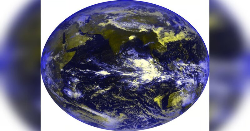
The latest meteorological satellite of the country, INSAT-3DS, has captured vibrant images of the Earth, displaying dynamic tints and colors. These images prominently feature the outline of India, presented in mesmerizing hues across the spectrum. Launched on February 17, 2024, through collaboration between the Indian Space Research Organisation (ISRO) and the Ministry of Earth Sciences, the spacecraft underwent several orbit-raising operations before reaching its designated geostationary slot or In Orbit Testing (IOT) by February 28, 2024.
ISRO has reported that the satellite has commenced Earth imaging operations, with the initial set of images captured by the meteorological payloads, including a 6-channel Imager and a 19-channel Sounder, on March 7. According to a statement by the space agency, the payload parameters are within the nominal range, meeting the specifications set for the payloads of INSAT-3DS.
The 6-channel imager is designed to capture images of the Earth’s surface and atmosphere across various spectral channels or wavelengths. These images are expected to provide valuable data on a wide range of atmospheric and surface phenomena, including clouds, aerosols, land surface temperature, vegetation health, and water vapor distribution. Additionally, the 9-channel sounder is tasked with capturing radiation emitted by the Earth’s atmosphere, such as water vapor, ozone, carbon dioxide, and other gases. ISRO has emphasized that these payloads generate more than 40 geophysical data products, catering to diverse user community needs, including sea surface temperature, rainfall, land surface temperature, and atmospheric motion vectors.
Post Your Comments